Blog & Newsletters

NPC24-Reflections
We thoroughly enjoyed the 2024 National Planning Conference (NPC24) hosted by the American Planning Association (APA) in Minneapolis, Minnesota!

Lets Talk Tech - Technology and its role in Plannings Future
On January 1st, few of us could have predicted what was about tounfold. Now, halfway through 2022,let’s evaluate the trends the global pandemic accelerated, and peek into how these trends impacts the future of cities and local government.
.png)
City of Borger implements Citizen Problem Reporter - paving the way for transparent city governance
Individual citizens often see minor, non-emergency problems – like a pothole or graffiti – before local government staff. Many cities use a 311-type system, offering people an option for alerting government staff to these problem areas, and hopefully directing them towards a quick fix

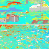
City of Rocky Mount created a Digital Twin with the use of Esri’s ArcGIS 3D Basemap solutions
Every city–small, suburban, or urban–strives to provide its citizens with user-friendly and accessible government services...

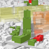
City of Rocky Mount, NC leverages ArcGIS Urban to solve its growing housing demand needs.
Rocky Mount, North Carolina faces significant development pressure as a result of several economic factors. Housing demand exceeds supply, particularly at a price point affordable to the middle class.

ArcGIS Urban: Future of City Planning
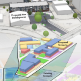
One of the long-standing problems with city planning is how to translate large area proposals with land use, zoning ordinance adjustments, economic concerns, and population requirements with localized visuals of site-specific scenarios

Lets Talk Tech: Technology and its role in Planning's Future
On January 1st, few of us could have predicted what was about to unfold. Now, halfway through 2020, let’s evaluate the trends the global pandemic accelerated, and peek into how these trends impacts the future of cities and local government

City of Borger deploys Esri's Work Order Management System
The City of Borger is a small town in the Texas Panhandle, north of Amarillo. In an era of tightbudgets and growing needs, the city recognized a need to improve operational efficiencies and particularly, the interactions ...

Partnership announced with enCodePlus - Municipal Planning Software
The partnership between enCodePlus municipal planning software and GIS platform developer ViewPro is a clear example of the whole equaling more than the sum of its parts.


